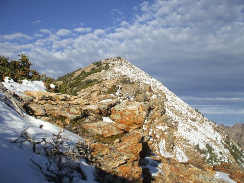
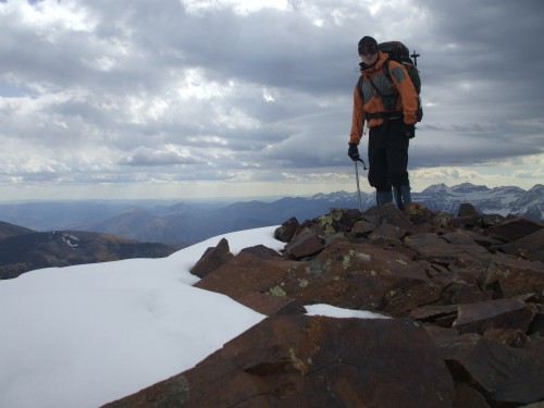
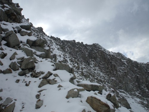
Near the top of Sugarloaf Peak
Holly dropped me off at the Cecret / Secret Lake Trailhead at 7:30 in the morning and I proceeded to hike up the trail to Secret Lake. My first mountain of the day, Sugarloaf Peak, dominated the landscape behind Secret Lake. The entire north face from the lake to the Devil’s Castle-Sugarloaf saddle was covered with snow ranging in depth from six to eighteen inches. This, combined with the harsh winds as I neared the saddle, caused me to expend much more energy than I had anticipated on this first “easy” mountain of the septet. Thankfully, the final ridge to the summit was mostly clear of snow and I just had to deal with the strong south wind the rest of the way. By 9 o’clock, I had at least completed one Wasatch summit!
Forty-five minutes later I was standing on the summit of Mount Baldy, inspecting the small weather station positioned there. The miniature windmill was spinning frantically in the fierce wind, and I did not stay long.
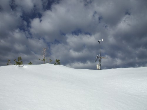
Mount Baldy Summit
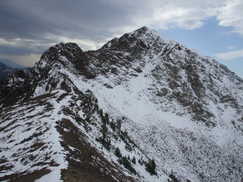
Summit #3 of the day was perhaps the ugliest mountain I’ve ever laid eyes on. “Hidden Peak” is more of a high hill including buildings, ski lifts, ATVs, and a road that winds the whole way around the slopes to the summit. I arrived at this summit at 10:20 a.m. As I previewed the next mountain on my agenda, I was well aware that the first three summits of the day were simply bumps on my path compared to what lay ahead.
The northeast ridge route to American Fork Twin Peaks provided some of my most enjoyable scrambling of the day, with the solid rock of the knife edge and the ridge beyond. The climbing was not the problem; it was the gusts of wind from the west that freaked me out a little bit as I walked across several short catwalks with no handholds. A couple times I actually crawled about ten feet just to avoid being blown from the ridge.
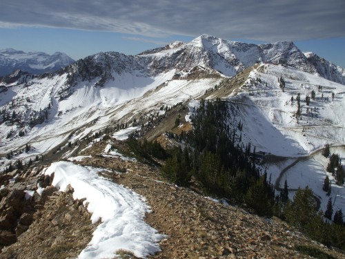
From Baldy: Hidden Peak and the AF Twin Peaks
Beyond the knife edge I continued scrambling up the snow-covered black rock until I arrived at the hiking trail above. From there it was a steep snow slog to the eastern summit of American Fork Twin Peaks, then an easy walk across the saddle to arrive at the highest point at noon.
Twenty minutes later, I was on top of the day’s easiest mountain. The rock of Red Top (or “Red Stack”) is indeed blood red. The views were fantastic as I hung around at the summit for about ten minutes to make gear adjustments and, well, rest.
To this point, I was feeling great and had been making decent time on the traverse. However, that short rest on Red Top was important because the climbing was about to get a lot more interesting and time-consuming. For starters, I stupidly strayed from the west ridge to follow the slopes below, and had to climb to the ridge again to continue my descent.
American Fork Twin Peaks
Eventually I reached the bottom of the ridge, then the climb of Red Baldy began. The steep scramble to the top of the obstacle buttress involved a lot of snow, and from the top, the view of Red Baldy’s east ridge was intimidating.
Here, I don't know what happened. I climbed to a notch in the ridge, and from there I just couldn't find a third class option. Perhaps I just overlooked an easy step, but after quite some time all I could find was overhanging cliffs requiring technical climbing to continue. Taking the second option, I followed ledges along the southwest face. These ledges turned out to be my third, fourth and fifth options as well. Every ledge eventually led to nowhere, and a return to inspect the original option at the ridge notch led to no different conclusions.
On Red Top
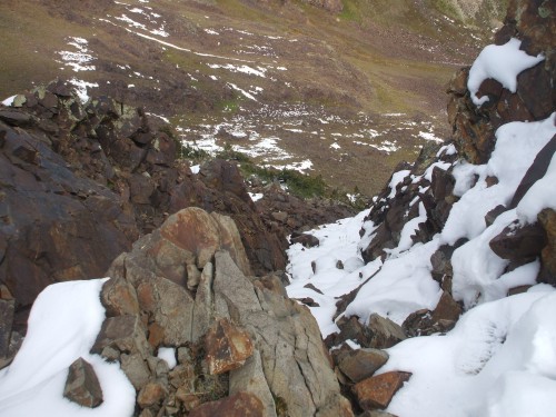
Reluctantly, but out of necessity, I worked my way west and downhill along the face until I reached the obvious south couloir. I had been eyeing this option since the buttress, and now this couloir was my last choice barring retreat. The couloir was steep and full of snow, and I found the slippery rocks underneath to be covered in ice. The chute was deeply inset between cliffs, and I found no escape options in either direction as I climbed. My hope was that I would be able to follow the south ridge upward from the top of the couloir, and this worked wonderfully.
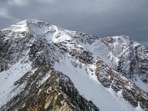
After a short scramble up and over to the true summit of Red Baldy, I breathed a huge sigh of relief. Thanks to my route-finding difficulties, it was now 3:20. The wind was as nasty as I expected, and the sky was now full of dark clouds. Still, the toughest summit of the traverse lay ahead–White Baldy.
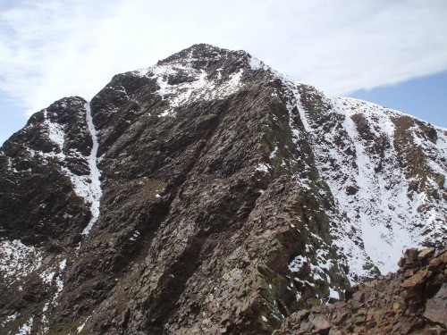
The Buttress and false summit of Red Baldy
I enjoyed the easy hiking from Red Baldy’s summit to the saddle, with the terrain changing dramatically from red rock to white in a matter of a couple footsteps. Suddenly, after having lived amidst the shards of slate-like rock for the past several hours, I was now immersed in a sea of smooth, rounded white boulders. Also, now deeper in the Wasatch than ever, I could see that I would have a lot more snow to deal with, but I was feeling good.
Looking back down the snowy buttress of Red Baldy
The problem with boulders and deep snow is that snow tends to fill in hidden gaps between boulders, while disguising the true shapes and sizes of rock surfaces. From the Red-White saddle, this made the going treacherous and time-consuming. White Baldy’s east ridge was also steep, causing me to go even slower as I carefully worked my way up over the snowy boulders. Eventually I decided to abandon the spiny ridge-crest to trek over to an obvious gully which would allow me to gain the upper ridge.
Red Baldy: ascent couloir on the left
Unfortunately, while the snow was not avalanche-prone, it was deep. En route across the north face toward the gully, I found myself wallowing through snow to above my waist. The scattered tumble of boulders underneath foot were not helping matters, either. Having gained at least some westward progress, I could see what appeared to be another option along the ridge, so I climbed back up to near the ridge-crest to see what I could see.
What I found was that my best chance for success was to return to my original path toward the gully. I was sure this would be feasible, and I would reach the summit eventually if I continued that direction.
Cold White Baldy
But my wristwatch gave me a reality check. As I sat there in the howling wind, I realized it was 4:50. I had been making painfully slow progress since leaving the saddle, and though I was probably halfway up the ridge, I was only going to slow down while trying to swim through the powder to the gully. I had never been in this area before, and I did not want to have to deal with a tricky descent to a snow-covered trail in the dark. The wind was blowing through me now, and though I had a parka in my pack, I decided it was a moot point: it was time to descend.
White Pine Lake appeared to be right below me, but it would take me over an hour to get there. This was due to humongous boulders which made up an endless boulder-field, covered in snow just as deep as what I had been dealing with on the slopes. After a fun controlled glissade down the slope, this tedious boulder-field would require my full attention until I finally met the White Pine Lake Trail. It was now 6:10, and beginning to get dark. I watched final sunlight illuminate Red Top as a pair of goofy-looking moose inspected me from the other side of the trail. Below timberline I continued descending into blackness, spooking several mule deer along the way.
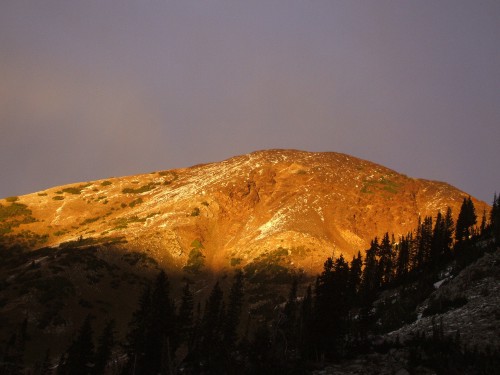
Red Top Sunset
It took me two hours of trail hiking with my flashlight before I finally arrived at the White Pine Lake Trailhead. After six and a half mountains in twelve and a half hours, I was thankful to see my wife parked at my destination. My first taste of the Wasatch was a memorable one, but at this point I was ready for a hot shower and a warm bed.