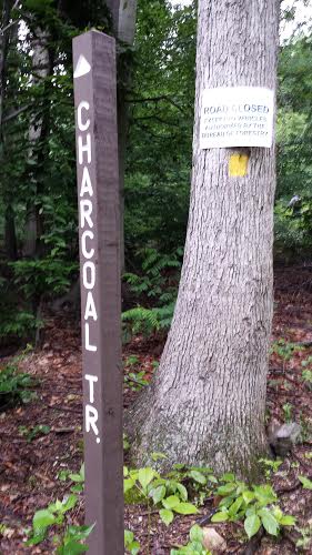
Dad, Uncle John and Hunter and I went for a wet hike on the new Charcoal Trail this morning. The lower end of the trail begins at the Rt. 75 game lands parking, which we did not know for sure until we parked there this morning to check it out. The trail follows the old logging road north along the lower slopes of Hogback Mountain, crossing over half a dozen or more charcoal flats, hence the name. The road eventually peters out and the trail stays on the public lands just above the Bricker development, passing near some of the houses. Eventually it winds around the surprisingly gentle northern spine of the ridge and meets up with the old (logging?) road on the other side of the Hogback--the road that eventually ends up at the saddle connecting the Hogback and Big Mountain. Eventually the trail ends up back in the hollow and finishes the easy (but very wet today) climb to the saddle. This ends the Charcoal Trail at 1.84 miles, and at this point it meets the Hogback Mountain Trail--which goes from the summit of Big Mountain to the summit of Hogback Mountain.
We detoured from here to scout around the mountain a bit.
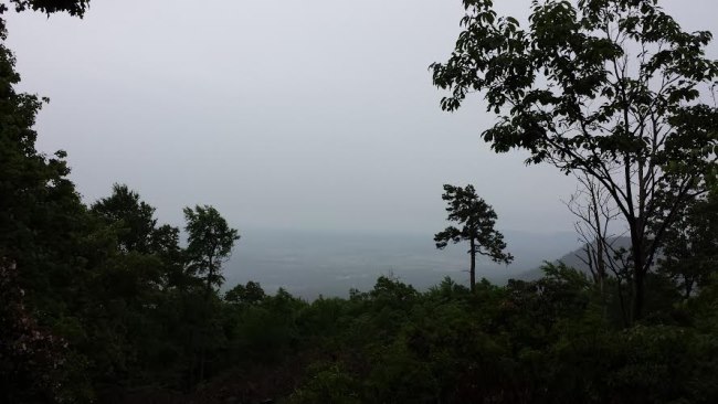
Back at the Hogback Mountain Trail / Charcoal Trail junction, we followed the Hogback Mountain Trail this time, as it began to rain lightly. It was 0.31 mile to the top of Hogback Mountain. There is a clearcut near the summit which allows an open view into the Cumberland Valley, but on this particular afternoon it was quite fogged over and we couldn't see anything.
We followed the strong deer trails down the steep slopes on the east face of Hogback Mountain. We jumped a deer that looked like it had antlers but we only caught a glimpse of it. Hike total: 5 miles.