Early this afternoon, Logan and I found ourselves at Chautauqua Park near Boulder.
Logan wanted to go ahead and climb the rock wall staring down at us from the large hill to the north. The only problem was, the slope up to there was covered in poison ivy. So, we started walking back the Gregory Canyon Trail until we found an ivy-clear opening above us. We hiked up the steep slope to the base of the rock formation and started climbing. I made it up a short ways and Logan was not able to follow due to the un-gripping soles of his boots. After a short fall, he decided he would find another route. That he did, and before long he was way above, looking down at me.
Our directions to the trailhead:
Gee thanks, MapQuest.
Finally, after some more maneuvering, I caught up with Logan and we continued up to the top of the rock formation to find a good view. . . and smooth ground leading right across to a paved road. Oh well, that didn’t make it any less fun of an adventure.
Next we went back down the steep hill and headed back to the parking lot to look for a trail up to the Flatirons. The trail we ended up following was the Bluebell Baird Trail, which led over a grassy knoll to an evergreen-laden hill behind a large meadow. We continued onto several different trails, which became steadily steeper as we closed in on the steep mountainside.
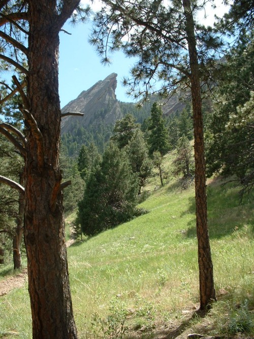
Third Flatiron, through the trees
As we continued up the mountain, we were awarded with closer and more outstanding views of the impressive almost-vertical slabs of rock forming the three “Flatirons.” After almost countless switchbacks, we found ourselves at the base of the First Flatiron. Continuing up the trail, we followed along the north edge of the Second Flatiron, all the way to the saddle at the mountaintop between the First and Second Flatiron. To get any higher from here we would have had to go rock climbing for real, which neither of us were really prepared to do. We did see a few climbers on the first Flatiron, however, and took some pictures while we were there.
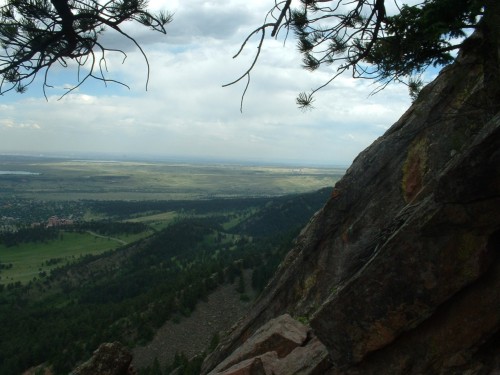
I was a bit disappointed that we couldn’t actually see the Rockies from this vantage point, but we did have excellent views of the other Flatirons, as well as Boulder and the Great Plains. On top of that, the beautiful, warm, sunny weather and the plentiful green foliage, along with being able to have a friend along, made this a very enjoyable hike. Logan and I headed back out the same way we went in, and called it a day. Altogether, the hike was well under five miles in length and our elevation was probably not much more than six thousand feet, but it was a fun hike anyway.